
This a small selection of the resources available online to you today for planning gravel bike routes. We asked our resident route designing guru and creator of the European Divide Trail, Andy Cox, to give us his advice about planning good cycling routes. We hope this helps to give you confidence to plan and ride in different places, to explore your local area or try out new routes in new places.
Finding good off road tracks can seem daunting, but there's loads of online resources that you can use to help you out. Finding new routes to ride is a great way to increase your motivation to get out, to explore more, to learn more about your local area, and can give you confidence to go further and to go to new areas. Once you’ve got a better idea of what works and what doesn’t, it's then pretty straightforward to go and find new trails to ride. And remember, out and back routes can be surprisingly interesting, as riding both ways on trails can be a completely different experience, as the views and difficulties or fun parts are entirely different the other way around.
The Online Resources:
This is an easy to use website that's best used as a reference while creating the actual route on another website or app. And it's only really usable on a full size browser, rather than on a phone. The automatic routing just uses Google, so it's only really useful for road riding the fastest way possible, but having Ordnance survey and OpenCycleMaps on the same screen can be really good if you're planning a route that follows both bridleways ect and National Cycle Network routes.
I feel that as a free resource, this is great. I’ve been using it off and on for years, and while the automatic routing is very limited, the fact you have two maps open at the same time is great and fast.

This is a great resource to see where others ride, what trails are used most, and which way to go if there's multiple options. Be aware though that just because loads of people ride a trail, does not mean it's actually legal to ride it, but local knowledge can lead to some great discoveries.
Free to use, but the greatest detail costs extra.
Strava certainly has its benefits, the routing is pretty good and it’s an easy to use format. The Heatmaps is where it stands out from the rest, as you can then see where everyone rides, because everyone uses Strava, right ?!? Personally I don't often use it, mostly as I don’t pay for premium so features are very limited.

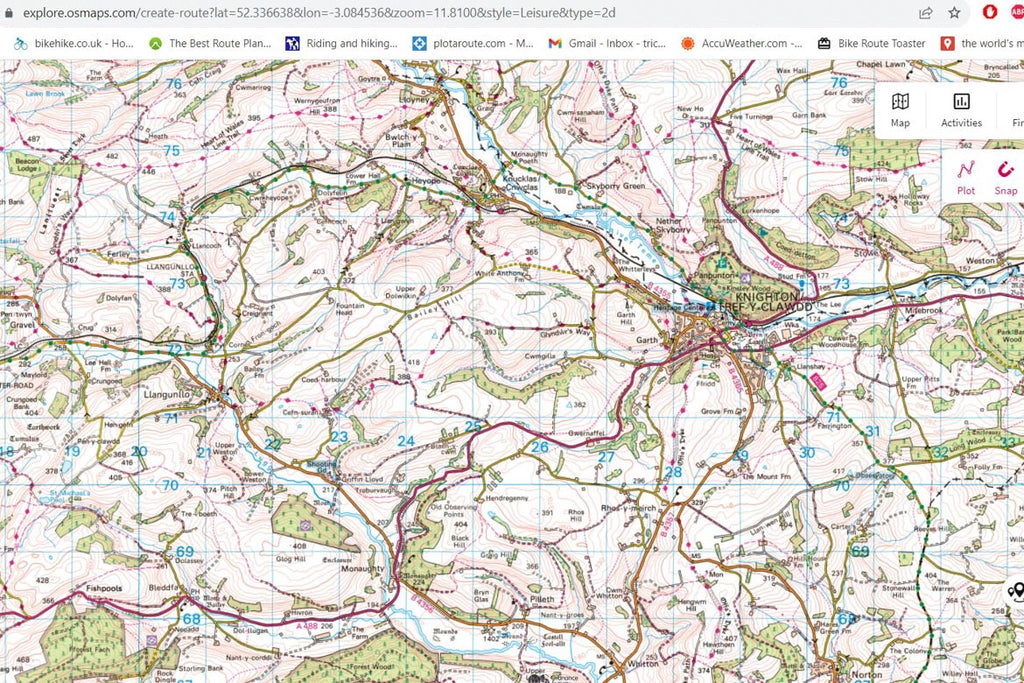
For the UK this is a must. The Ordnance Survey are the original high detail maps, giving a well portrayed layout of the different options available to ride. It's not always completely precise, in terms of where the tracks cross a landscape, especially in dense forest or across open grassland, but it's the best resource for the UK.
It's about £30 a year for full access.
Ordnance Survey are the definitive maps of the British Isles, the standard that all others, worldwide, are measured by. Not perfect, and the routing software can be frustrating, it not finding tracks or routing onto footpaths or busy roads when there are alternatives, but as a go to resource for tracks and trails, and all the other points of interest on a map, I always have it open in a browser or on my phone.

This is a good and easy to use app and website, automatic routing is good, with loads of options for different modes of transport. As with all these things it's far from perfect when it comes to the details of planning, with it sometimes not finding the route you want, rerouting onto tracks that aren't actually there on the ground and other problems. It does however have a thing called Trail View, which is where members on the platform can upload pictures of the actual trail onto the database, putting a marker down where the photo was taken, so this can be a really useful addition.
Only minimal access for free, and the rest costs up to £60 a year.
Ah Komoot, so much to like and dislike in the same place. Both incredibly useful, the trail view and highlights, and hugely frustrating, the constant routing changes when reloading a route, and the lack of functionality that the app has versus the website.

Ride with GPS is much the same as Komoot and Strava for creating different routes, and it depends, in the end, which of these platforms you have used before, which you’re willing to pay for.
Free for basic features, subscription for more.
I’ve very little experience of using this, except that a lot of North American routes are on here, so I’ve often downloaded gps files from here, that you can do without having to sign up, which is nice.

Google maps, Earth and Street View
This is now a really valuable resource for planning routes, being able to see whether a route actually appears on the ground using Google Earth/satellite view, whether it’s a route on Google Maps, or, as with Street View, to see how the trail looks as it crosses a road or if it’s had a Google car along it.
Free to use
Google, taking over the world and our lives… It’s great, nothing else comes close in terms of speed and ease of use, content and user experience are excellent, but it’s Google, so your data is theirs. I use it all the time when planning all sorts of rides, but it’s often wrong, as it’s user submitted data, and your data is sold off.

This is a fantastic user submitted resource of off road routes around the world that’s slowly getting bigger and better all the time. It’s easy to use, easy to download from and has a fair bit of information and links for some of the routes and sections.
Free to use
I am happy that this exists, and the more people use it, the more it’s a useful resource. Often not ‘Gravel’ though, so check out the route in other places before committing to a gravel route that’s actually an mtb or road one.

While this doesn’t cover the UK at all, this is a fantastic resource for finding off road routes in Europe. It is based around Openstreetmap data, but collated in such a way that it’s more like using Ordnance Survey mapping. Having multiple different designations for each type of hiking trail, with grades of extremity, and 6 or 7 different types of dirt roads/double-tracks, there’s plenty of detail for planning routes using it as a reference guide while creating the route on another website or app. Also available to download for free to put onto your GPS device.
Free to use
I planned a lot of the European Divide Train using a mixture of this and Komoot, so highly recommended. Often updated, so it’s worth getting the latest version of the maps. A bit too detail rich for planning longer routes using just this, and the website can be really slow sometimes, but the EDT wouldn’t be as it is without this resource.

How to Plan a Gravel Ride:
Clearly distance and location are your choice, so giving location specific advice about how to plan routes is impossible, but I will share a bunch of tips and tricks to help you in finding a good route using the above tools.
Trying to plan a route that's completely off road in the UK is difficult, as you will often end up on footpaths, which if you don’t know, are illegal to ride a bike on in the UK. You are however allowed to ride on all the other tracks listed on the OS maps.

Across the world rights of way for bicycles vary greatly, with national parks and wilderness areas being generally off limits, except for marked and permitted routes, national forests and forestry commission lands, on the other hand, being mostly ok to ride in most places.
When planning a route it’s good to think of it like telling a story, as in you should try to have a destination in mind, be that some way into it or as an end point, perhaps a coffee shop, historical place or interesting geological feature or viewpoint. This gives the ride a purpose, perhaps so you can name it, but also just as a reason to go for the ride in the first place.
It’s good to also think about the flow of the route you’re planning,
so things to keep in mind are:
How technical the trails are?
How fast rolling is it?
How much paved roads are included and how busy will they be?
Is there a time of day that’s better to ride certain parts than others?
Trail conditions at that time of year? (Mud, ice, snow, rain, dust, overgrown ect)
Food and drink stops?
Mountain passes and the weather?
Bail-out options in case you have mechanical/energy/technical issues?
Point to point with a lift back or public transport?
Or in a loop?
And for overnight trips:
Where will you spend the night? (inside, outside, camping or bivvy, in a campsite or wild camp?)
Restocking with water and food before you stop for the night?
As you can see, there's loads of options and potential issues, so many in fact that you might get ‘decision inertia’ and not be able to decide or even start planning, but there are plenty of already made and ridden routes out there, so you can always adapt those to your needs.
And finally, think hard about the distances and terrain you’re planning to ride in. There’s a big difference between clicking away on a map for a few hours, putting together a nice looking route and the harsh reality of rough trails and steep hills. If you’re not used to the terrain you’re planning to ride in, the surfaces of the trails, the length, steepness and amount of hills, then be conservative in your daily distances, at least until you are used to the area.

Things to be aware of when planning a route:
Linking tracks together through planted forests can be a nightmare, as there’s no guarantee that the tracks on a map exist at all, and they could easily have grown over from lack of use or never existed in the first place. The same with open country, moors, marshes, prairie ect. If the track you're planning riding on is completely straight on the map, then there’s potential for it not to exist on the ground like that, so be prepared to only follow the general direction, and not try to stick religiously to the route. Unless this is a manmade track, like an old railway line or similar, then these are usually very straight with cuttings through hills and bridges over hollows and valleys.
Steps, fences and gates, too steep trails gullies, waterfalls, river and stream crossings (fords), cliffs, motorways or even just busy roads, railway crossings, passenger or vehicle ferries, trains and other obstructions can all cause your route to not work at all. Most of these can be worked around through detailed searching on various maps while you’re planning, so if there looks like a viable route that you’ve got your eye on, but there's a small linking section that doesn’t seem to be used much then that’s probably for a reason. This can be where a mixture of Strava Heatmaps and Google Earth view can really help, being able to see if anyone ever goes through there, or seeing it from above to see if there’s a track visible, or in the 3D view, to see how steep it is.
For instance, in the mountains there’s often only a few ways through them, one of which is often paved, and perhaps also a footpath alternative. If the pass you want to cross has a name, then it’s worth a quick Google search for it to see what comes up. Are there pictures or trail reports? Does it look steep/rough? Is it in a protected area? Does it look fun?
Bailout/cutoff options are a very good thing to plan for. Have a look at your route and think about where you expect to be at certain times. Can you backtrack and get to a road easily at various points? What if it all goes wrong, how far will you have to push to get to a road? It’s worth thinking of these things before you commit to a massive route with few cutoff points or bailout options.
As they say;
‘Hope for the best,
Plan for the worst’.

How to gauge others routes:
Route difficulty is a really subjective and deceptive thing. How your fitness, skills, willingness to push your bike, or indeed put up with technical riding for an amount of time, vary against others is all very difficult to judge. Some people love to ride steep ups and downs, some hate busy roads and will do anything to keep away from them, whereas others don’t mind riding in fast traffic as a means to an end.
Discovering these things is part of the fun of planning routes and finding out your limits, and this is where the ‘social’ aspects of some of the route planning platforms can really help. Being able to read comments or reviews of routes or trails that others have posted can be really useful. Komoot, Strava and Ride With Gps all have these features, so it’s worth doing research with online searches to help narrow down what you want to ride and where.

Conclusion:
Ultimately planning, creating and riding new routes is good for the soul. Exploring your environment by bicycle is a great way to see the world, to discover new places and have a good time. When trying to find new routes around an area you will often find parts that don’t work, so it’s worth a think about the reasons you think this:
Is it the time of year? Direction of travel? Tyre or bike choice? What were your energy levels like when you tried that section? Could it be better at the beginning rather than end of a ride? Was the route you rode only good in retrospection? As in, was it ‘type 2 fun’?
All of these things will alter your experience, potentially clouding your judgment, but they’re all valid reasons to like or dislike the route, be that yours or someone else's.
In the end planning too much can also spoil the fun, so just going out to see what you can find, with no real plan, can be a great way to explore. Getting lost can be fun, if you’ve got nowhere to be at any set time, as if you’re recording the route on a gps device you’re never really all that lost, as you can always backtrack and follow the route you took in and follow it back again.
Bikes are a great tool for exploration, and gravel bikes are an almost perfect mixture of on and off road performance, meaning you can get places quickly, ride the rough and the smooth without much drama, and still get home on the road if it doesn’t work out in the end. The ultimate All Terrain Machine.
